In March of this year, I attempted a hike to the summit of Mount Nancy in New Hampshire. The mountain is on the Appalachian Club’s 100 Highest List. I wrote a tongue in cheek post on this blog not long after the hike, that’s here.
Denied from reaching my goal, I returned to New York’s Catskills until the snow cleared. This month, I returned to New Hampshire to check the box.
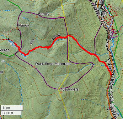
The hike is approximately a 9+ mile round trip, with a mile of bushwacking off established trails to the summit.
I arrived late, around 9:30am. I estimated 7 hours, allowing extra time for compass and GPS navigation.
I was traveling light. A 22L pack, no showshoes, spikes or heavy layers to slow me down. I carried 2 liters of water, a sandwich, the ten essentials, a wind shirt and my summer poles.
Starting from the same trailhead, I reviewed my previous hike, where I reached Norcross Pond before turning back.
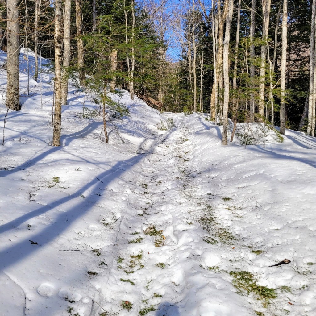
The sky was clear and the sun burned off a layer of morning fog. The trail would reveal itself today to present a very different hike indeed.
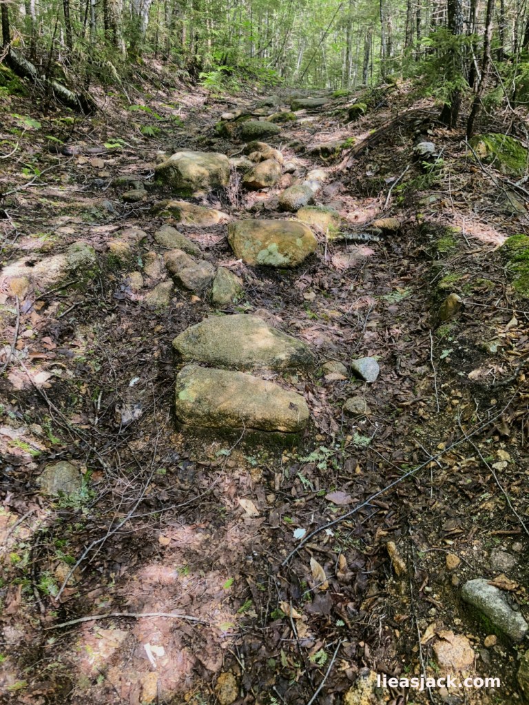
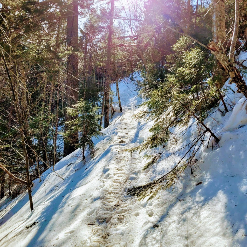
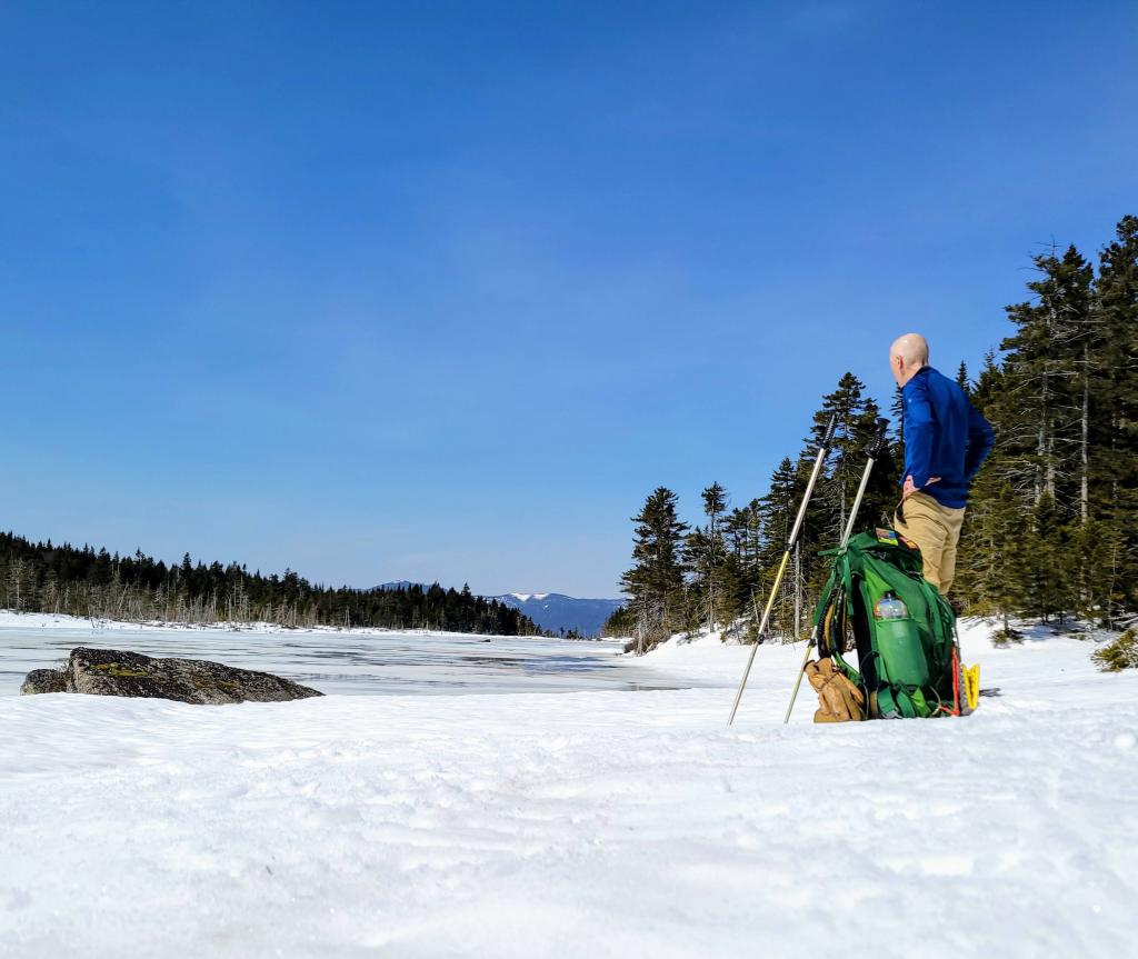
Instead of a carpet of sticky white snow as shown below in March, it was an uneven trail of large stones and baby heads.
The ice covered streams I had crossed in snowshoes and spikes gushed with water from the previous day’s rain. I had no issues rock hopping the streams and made good time in my Altras.
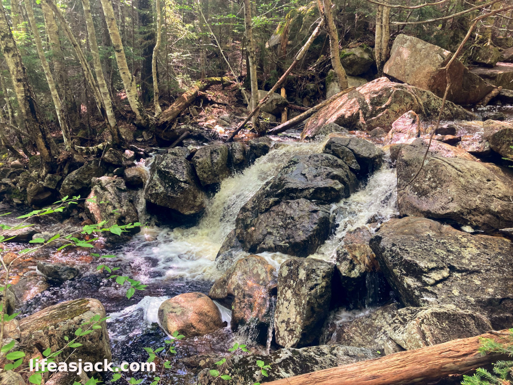
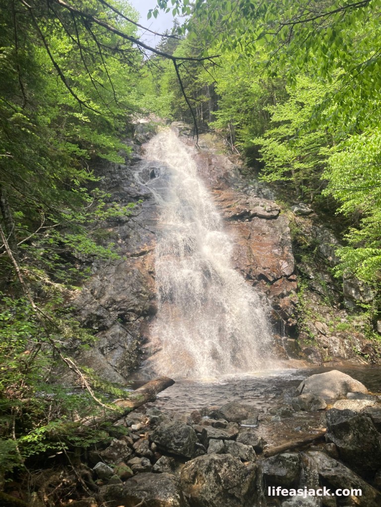
A few miles in, the trail began a more pronounced climb. I had been ascending at a steady pace, but now I could head thundering water. I knew I had reached the Nancy Cascades. The roaring falls had been mute in March. What water that remained unfrozen in winter ran under the ice and snow hidden from view. Now the waterfalls ran freely.
Hiking past the falls, I made my way towards Nancy and Norcross Ponds. The ponds sit just above 3000 feet of elevation, between Nancy and Andersen Mountain.
Below my feet in March, I had trudged along a flat path of snow. Now I could see what was hidden beneath the three foot snow pack.
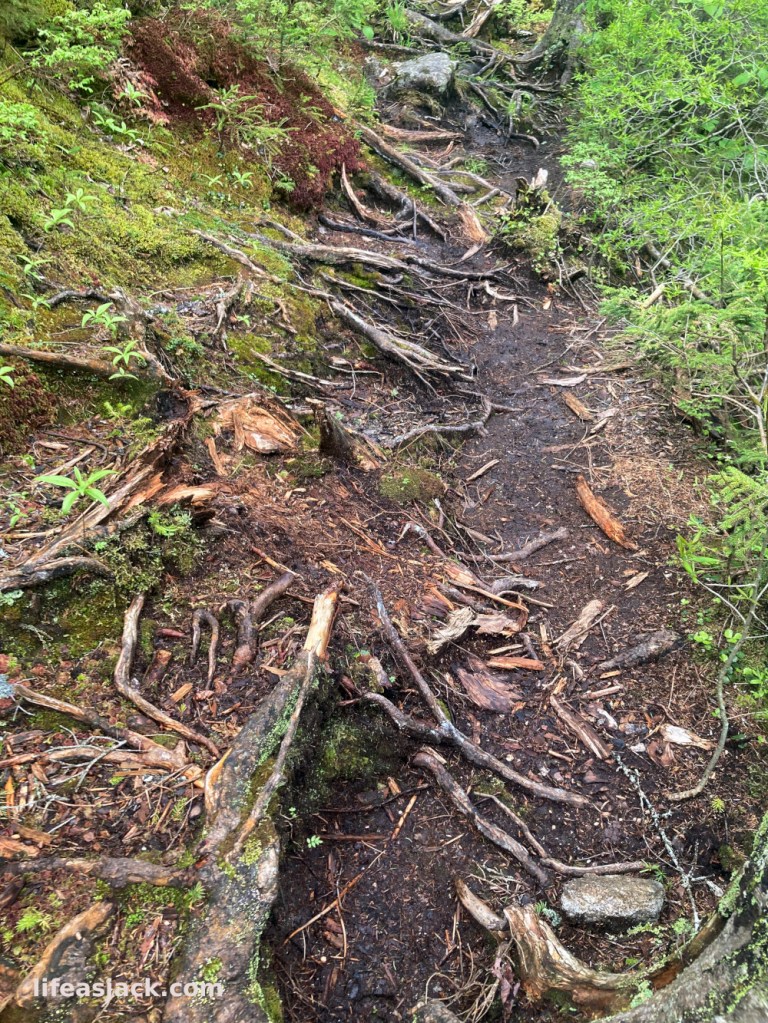
The trail was not unlike many in New Hampshire. A tangle of roots and stones, with boot sucking mud from the spring rains.
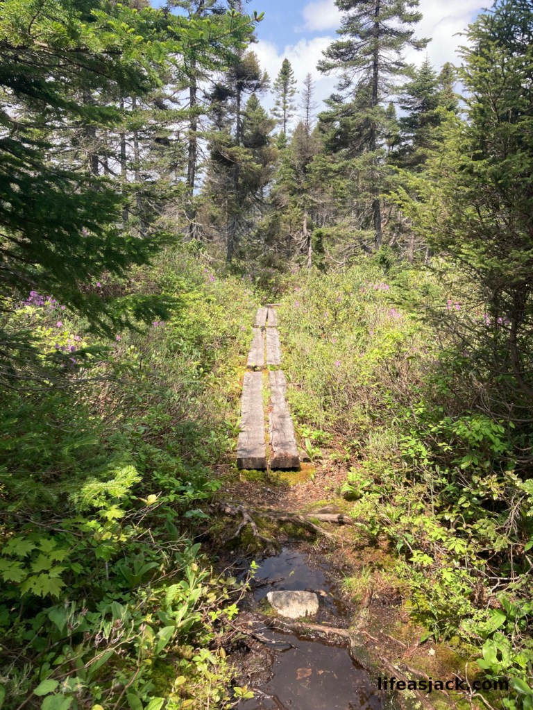
Surprisingly, I began to encounter a series of bog bridges over the swampier sections of the trail leading to the ponds. I had walked well above these without even knowing it on my previous hike.
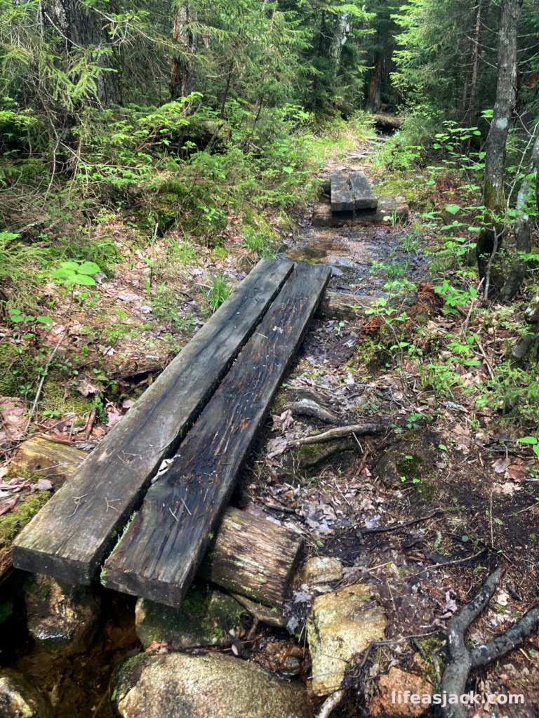
In some instances it was wise to keep boots on the ground and not use the bridges. Over time, they can become quite slippery with a coating of slime and moss.
Finally I reached Nancy Pond. In winter I had traveled along the frozen edge of the pond. The trail was actually much deeper in the woods. I had been a bit off course, but had made better time in the snow here. Now the trail was a soup of standing water, roots, bog bridges and mud.
Nancy Pond, New Hampshire USA
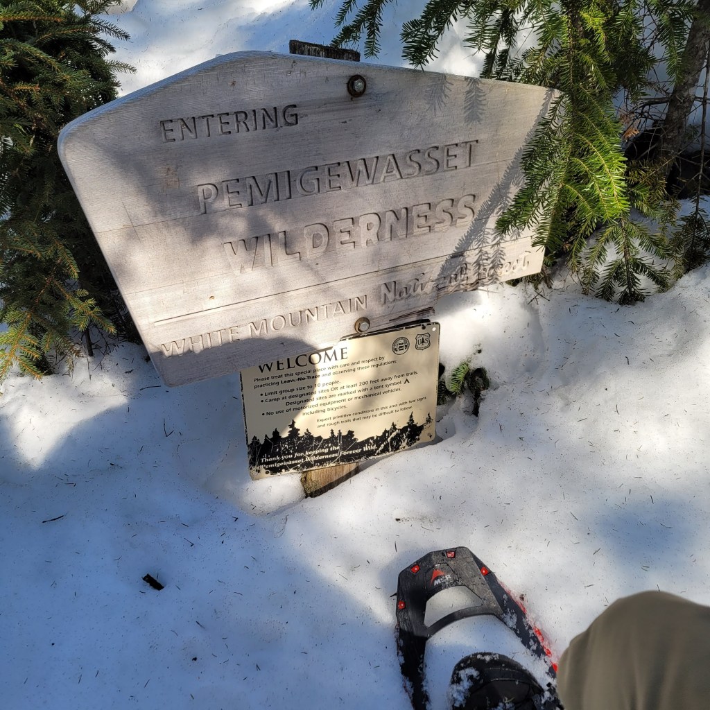
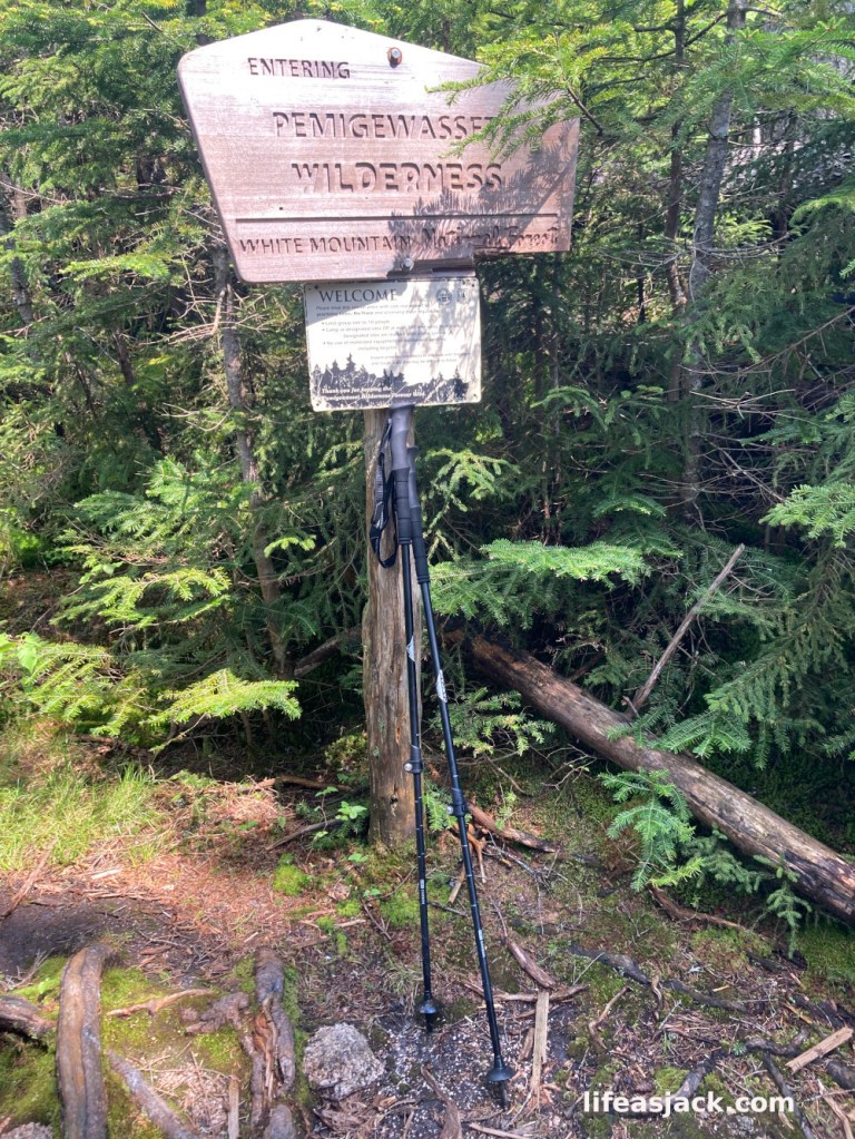
Approaching Norcross Pond, I arrived at the sign announcing my entry into the Pemigewasset Wilderness. Either the sign was taller or I was shorter now! My trekking poles indicate the difference in snow depth from the previous hike. ( note my foot and snowshoe in the bottom right corner of the image.)
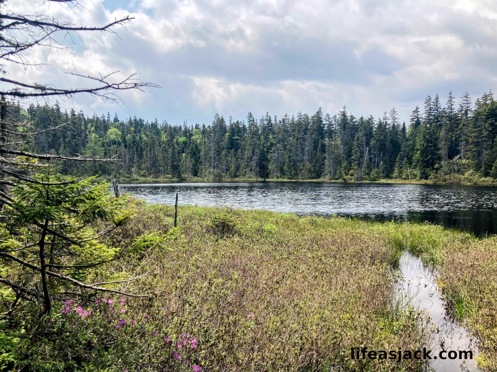
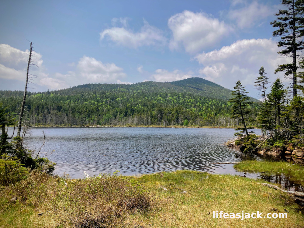
Finally, I reached Norcross Pond. Andersen Mountain rose above the far side of the pond, Nancy behind me.
Norcross Pond in March
Norcross Pond, New Hampshire, USA
It was time to make my way to the summit.
(To be continued : Check back for Part Two! )

Comments
One response to “Mount Nancy”
[…] post follows part one here. Having decided to make a second attempt to hike Nancy, I returned to Norcross Pond via the Nancy […]
LikeLike