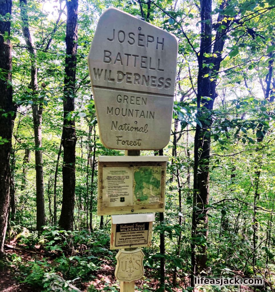
After crossing the Brandon Gap at midday, I had reentered the cool, shade of the forest. It was hot. Temperatures were not ideal for a strenuous hike. It was 85+F, and quite humid. I climbed a circuitous route to a sign located a few hundred yards along the trail past Brandon Gap.
According to the USFS website, The Joseph Battel Wilderness “was bequeathed as a “park” to Middlebury College by Joseph Battell in 1915. In his will, Battell directed the trustees of these lands to “preserve as far as reasonably may be the forests of said park, and neither to cut nor permit to be cut thereon any trees whatsoever except such as are dead or down and such as it may be necessary to cut in making and repairing needful roads; it being a principal object of this [will] to preserve intact such wild lands as a specimen of the original Vermont forest.”
The college did not honor Battel’s request. They later sold the land to the USFS in the 30s without restriction of development. After years of wrangling, the Federal government earmarked the land as a wilderness area that would be designated under the Johnson administration as “forever wild.”
The area is a habitat for black bear and trout, as well as a protected nesting areas in the Horrid Great Cliffs for peregrine falcons.
Passing the signage, I began to climb a steep section of trail that went on for what seemed to be forever.
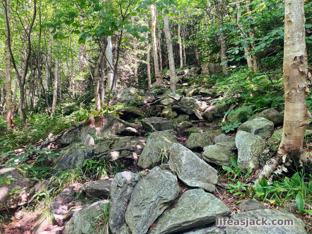
The terrain finally leveled off, but I was spent. A steep climb late in the afternoon was emptying my energy reserve, and the temperatures had made me a soggy mess. I hoped I was now on a ridgeline, but to my chagrin I continued to gain elevation. At first my gain in elevation was slight, but soon I was greeted by more steeps as I climbed towards Cape Lookout Mountain.
Stopping at Lookout, I considered if I wanted to review my map. I knew I would be let down by the fact that I still had some distance to go. I was down to a liter of water. My map confirmed I’d have approximately 5 miles to go to reach the shelter at Sucker Brook. I expected in this heat to have exhausted my water by then, and there was no indication of reliable water sources along the way. Black flies swarmed my head net, and covered my pack. It was time to move on.
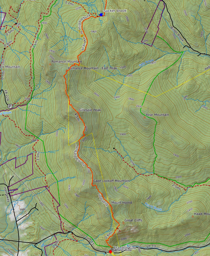
Although I was now traveling along the ridge, it would not be a cakewalk. I would descend at least 200′ before hiking over Gillespie Mountain as well as Romance Mountain. Romance was the tallest along the ridge from Cape Lookout at over 3000′. I would have to go up over the top to descend to the shelter, and water on the far side.
The trail was obscured by thick foliage in sections, and I passed over muddy sections of trail that indicated a water source, but nothing I might draw water from. I began descending and without looking at the map, knew I had summited Romance and was not far from my destination. I drank my last sip of water and soldiered on.
I soon found the spur trail to the shelter. I was disheartened by it’s further descent from the main trail, knowing I’d have to climb back to the elevation tomorrow.
I spotted the shelter ahead, it’s entrance hidden from view on the opposite side. Coming around the corner, I surveyed the open shelter’s front and the fire pit a few yards away. I dropped my pack on the ground and sat down heavily at the shelter entrance. A man was sitting in the shelter a few feet away. We looked at each other.
“Hello” he said.
