This Post is One Of A Three Part Series.
My hiking brother John needed many of the white mountains peaks to complete the list of New Hampshire 4000 footers.
We were out on a short hike near Providence, Rhode Island. It was early spring. The air was warm, the grey days of March fading into rainy April. I could see the buds on the branches above my head. soon we’d have some green cover. Last year’s leaves rustled underfoot.
“I want to get them all in one shot if I can.” John said.
I fished an apple from my pocket. I like eating apples while hiking. It was a one of those weirdly named apples from the grocery store. There are simply too many apple varieties now. My favorite is always named “On Sale”
“A traverse is no easy hike. We’ll need two or three days”
I said.
I took a bite with a resounding crunch. It was a juicy one alright. I wiped my chin.
“I’ll put something together.” I said.
If you’ve never heard of a Presidential Traverse, it’s one of the most strenuous hikes in the White Mountains of New Hampshire. You can read a detailed article on NewEngland.com here.
I had hiked all the 4000 footers in New Hampshire over a three years span some years before, but had mostly moved on. Back in those younger days, The hikes had been day hikes, bagging one or two at a time. I had never attempted a “Prezzie.” It’s a grueling hike, mostly above treeline, exposed to the elements. There are countless stories of epic presidential traverses and just as many of hikes gone wrong. I was older now and not as fast or flexible. The idea caused both excitement and apprehension. Could we pull it off?
The Plan
My plan was based on some solid research from other hiking blogs and past experience in the Whites. The two of us would never have the legs to do it in a single go. Based on a two day plan, we would hike up from the Appalachia Trailhead to the first mountain on his list: Mount Madison. We would then ascend to Mount Adams before spending the night below treeline at a lean-to shelter. “The Perch”shelter was maintained by the Randolph Hiking Club. The first come, first serve shelter was our favorite option, but we would carry tents as a backup. Hiking in from the Appalachia Trailhead give us a direct route to the Presidential Range with the most dramatic elevation gain of the hike. We would expend a great deal of our hiking capital in calories and endurance to get to Adams. On day two, we would hike over Mount Jefferson, Clay and Washington, the highest peak in the northeast. After Washington, all the other mountains would be a more gradual descent. The final peak on the traverse, Jackson was eliminated from the plan, as we had both already summited it in a previous season. All together, we would have to hike more than 20 miles (32Km), and gain almost 10,000 feet of elevation.

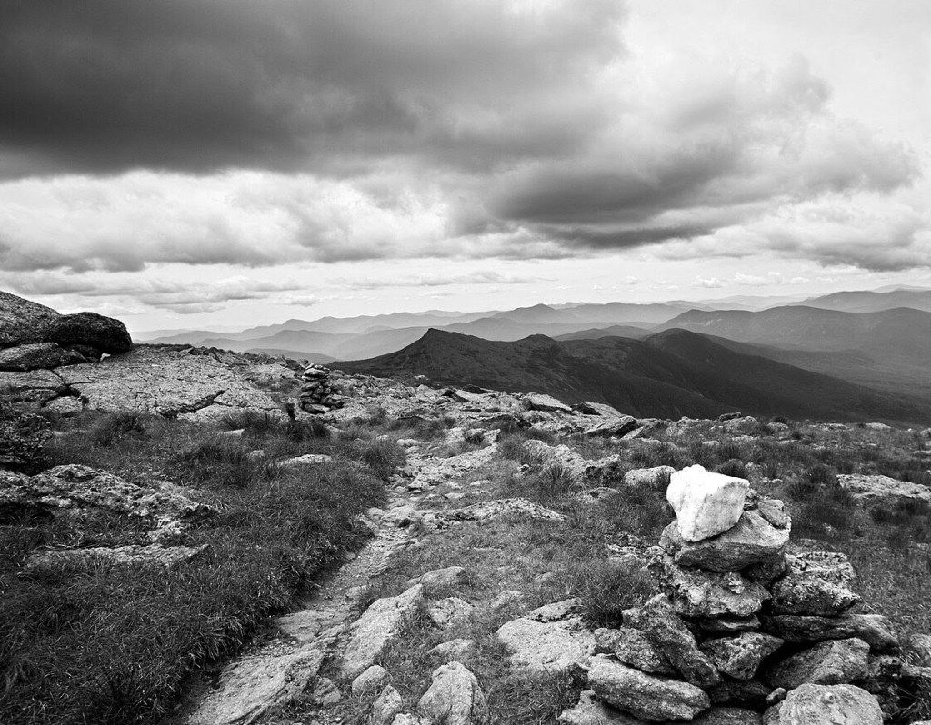
Hiking the Whites
I reminded my friend that day one would be tough. Full packs going up the steep trails. The White Mountains are really the “stubs” of great mountains that millions of years ago were comparable to the Andes. Glacier activity and erosion over millions of years wore down the Appalachian range to a very low level, only for them to be forced up again with later tectonic activity. The heat and pressure that created the mountains millions of years ago can still be seen today in the mountain’s bones. The super heated rock melted and folded, mixing with other different layers, now visible to the naked eye in the rock formations throughout the mountains.
New England Weather
There is a quote that’s oft attributed to Mark Twain, but may be that of his friend, Charles Dudley Warner:
“If you don’t like the weather in New England, just wait a few minutes.”
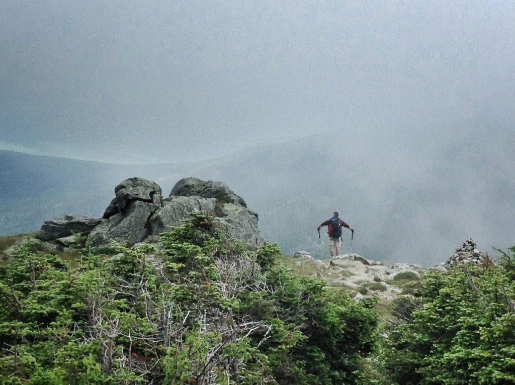
Mount Washington has a reputation as having the “worst weather in the world”. While the mountains are not the tallest or most formidable, Washington does hold the world record for highest wind speed, and if coming from a certain direction it will blow. Part of this is because its the tallest peak around. Wind coming across from the west out of the Dakotas has nothing to slow it down. The tallest Adirondacks in New York are still a thousand feet shy of Washington. That wind passes over those mountains and keeps going east, until it collides with Mount Washington. Twain or Warner were correct. New England weather is fickle. Snow in July is not impossible in the Whites. Strong thunderstorms can abruptly form on late summer afternoons. If things went wrong we’d bail out and come down with whatever we accomplished. If necessary we could stop at one of the huts located along our path operated by the Appalachian Mountain Club, at least to fill water bottles or eat.
Drop and Go.
To accomplish this one way hike, we needed to drop a car. We would leave one vehicle at near the Appalachian Club’s Highland Center, and then proceed to Appalachia. The date for the second week of July was set.

Comments
One response to “A Presidential Traverse- Part 1”
[…] hiking buddy John was intent on collecting several of the peaks in the White Mountains. The planning stage of the hike was now done, and it was time to execute. On a mild summer day in July, I drove to New Hampshire […]
LikeLike