Having business to do in northern Massachusetts, I decided to detour on the following day to one of New Hampshire’s favorite mountains.
Mount Monadnock, or Grand Mondanock, as it’s sometimes called, is one of the most popular peaks in the state. Due to the mountains accessibility, it’s also one of the most hiked in the world.
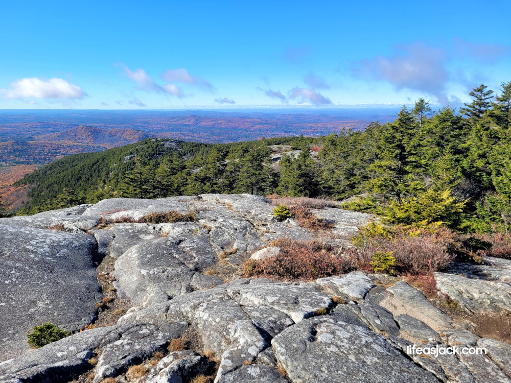
The mountains stands in Cheshire county in the town of Jaffrey. Reaching just over 3000F/914M, it’s not as tall as it’s neighbors to the north. It is the biggest game in town however, and from it’s summit you can see as far south as Boston and north to Mount Washington.
I began hiking the mountain more than a decade ago, and return at least once a year. I have hiked it with companions from my hiking clubs as well as my adult children. It’s a short hike to the summit, but a solid workout with scrambles up open ledges and rock hopping on it’s stony trails.
The mountain is so popular that it’s wise to book a reservation for parking at the park’s headquarters on Poole Road. A day use pass for the state park is $15. The fee is worth the cost of supporting the conservation efforts of the rangers and NH state parks in general.
I was outfitted with my basic winter pack, with the same load out I assembled for my recent hike to Mount Madison.
The morning temperature at the trailhead was 43F/6C, a fine crisp morning. The daily high might gain 10 to 15 more points, and there was nary a breeze here below the summit, in the safety of the forest cover.
I donned a fleece over my heavy base layer, and a windshirt over that. I put on a winter fleece hat amd a thin pair of gloves. My winter trekking poles are aluminum, and can be cold to the touch when temps are low.
I started late at 9:00, and crowds of hikers were already swarming the parking area, and trailhead.
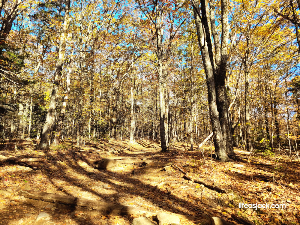
The White Dot Trail is marked with it’s namesake. It rises slowly at first. Several visitors of lesser years than I charged past me up the trail.
Mountain hiking requires patience. It’s important to regulate your body temperature and pace, to keep from over exerting yourself. Reaching a cold summit as a sweaty mess isn’t fun, and can be downright dangerous. Wet and clammy clothing cools the body and can lead to hypothermia.
As I progressed, I stripped off the wind shirt and fleece. I was burning calories and my body was warming up. I needed to vent some of that heat.
I stowed my hat and gloves, unzipping my collar to expose my neck and rolled up my sleeves. Exposing those pulse points where there are major blood flow allows better cooling.
At my constant measured pace, I soon passed the individuals that had only a short while earlier been charging up to the summit. Now that stood off to the side of the trail, catching their breath, dripping wet.
There are several scrambles up steep rock faces on the trail. I stowed my poles as I approached these, needing my hands to pull myself up. I had chose to wear my Xero mids. That don’t have a very aggressive tread for mud, but have a nice sticky rubber sole that worked well on the ledges.
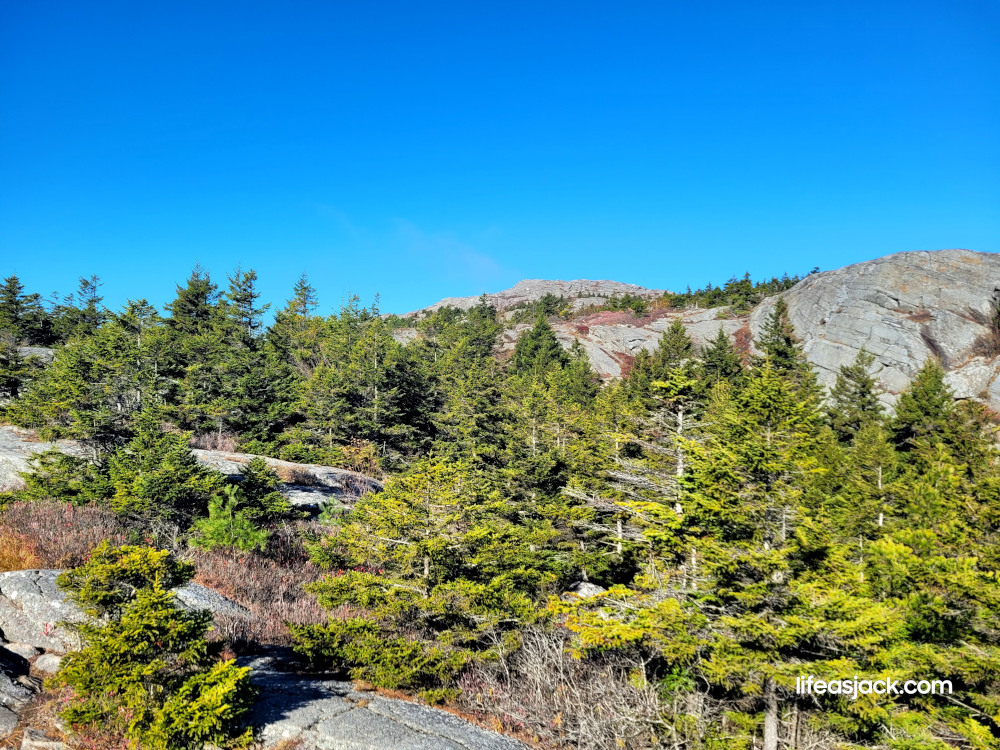
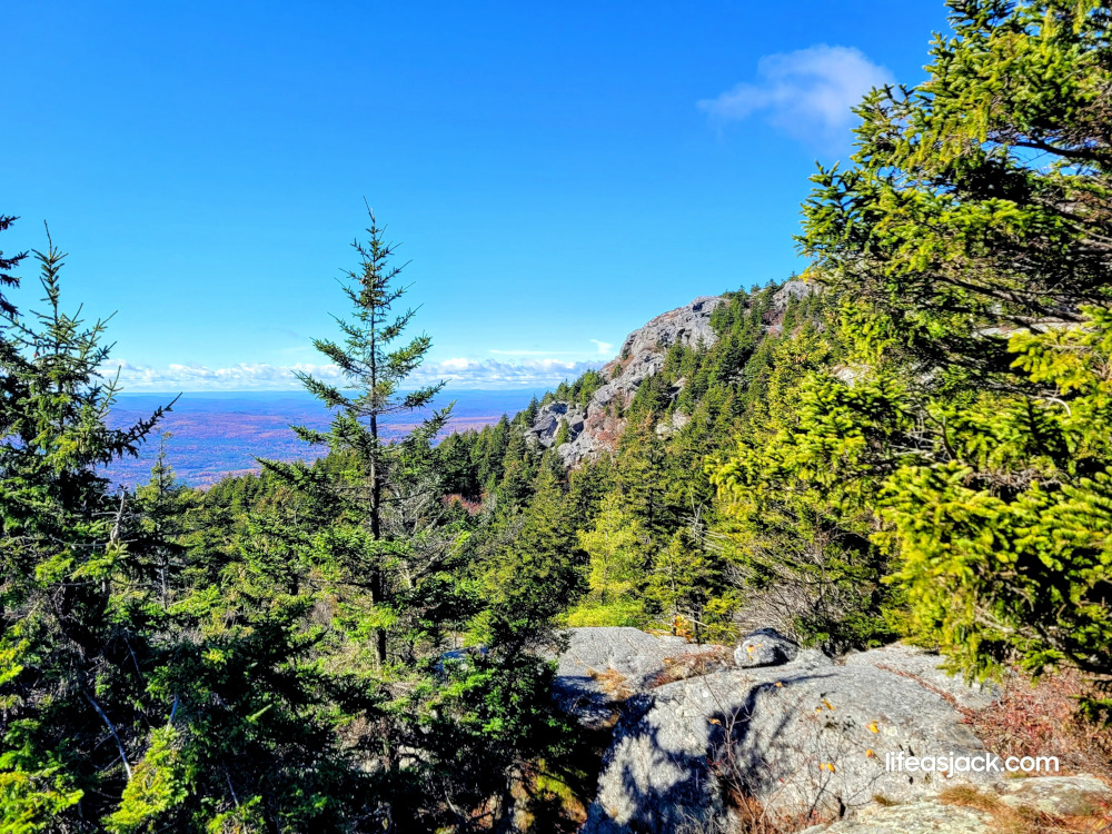
Having ascended to the first set of open ledges, I was able to treat myself to a fine fall view.

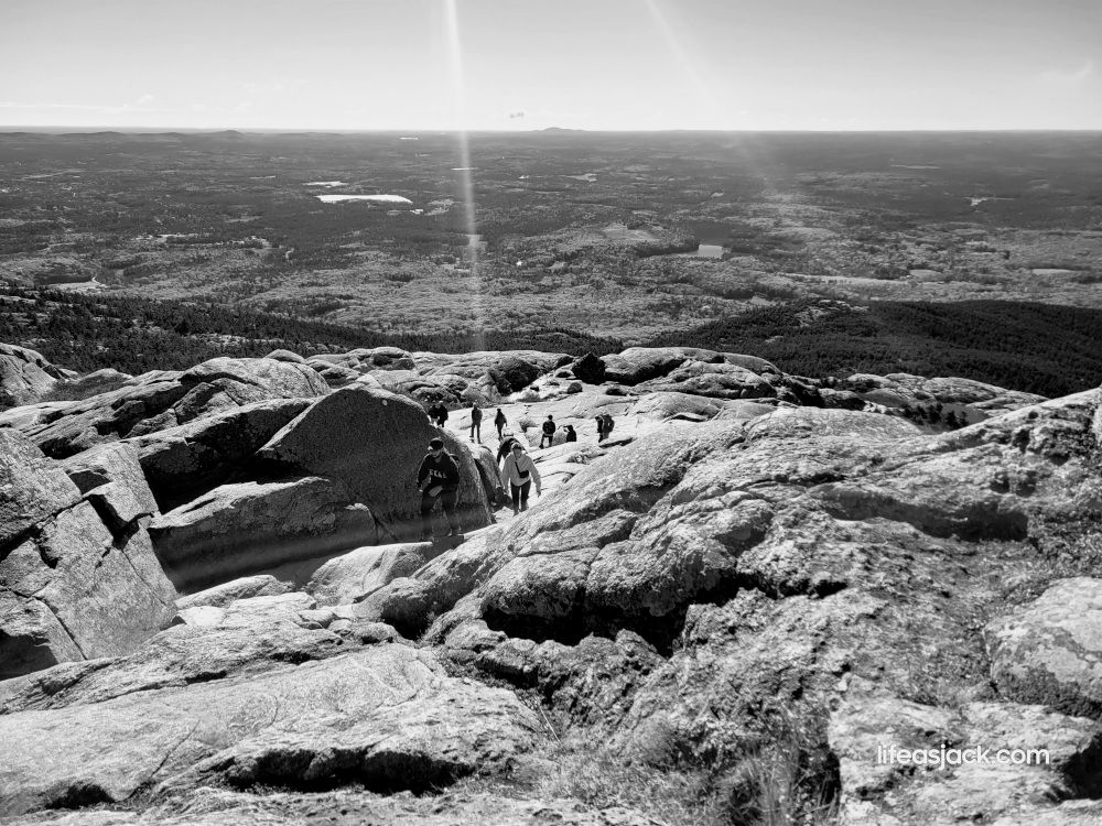
Looking back over my shoulder, the bald summit beckoned, but still seemed far away.
Several hikers behind me looked aghast that they still had far to go. Being unable to see above the ledge while climbing, they soon realized it was a “false summit.” There was still a half mile or so to travel before reaching the top.
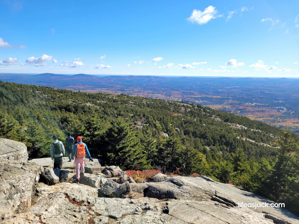
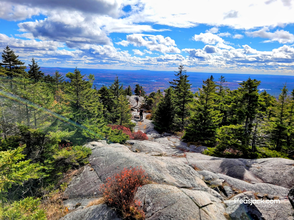
The trail descends thought the trees before once again coming out to some steep open ledge. This is the easiest and most fun section of the hike, and offers outstanding views. Without the shelter of the forest, the unrestricted wind can often be felt. I slipped the wind shirt back on over my base layer to reduce convection cooling.
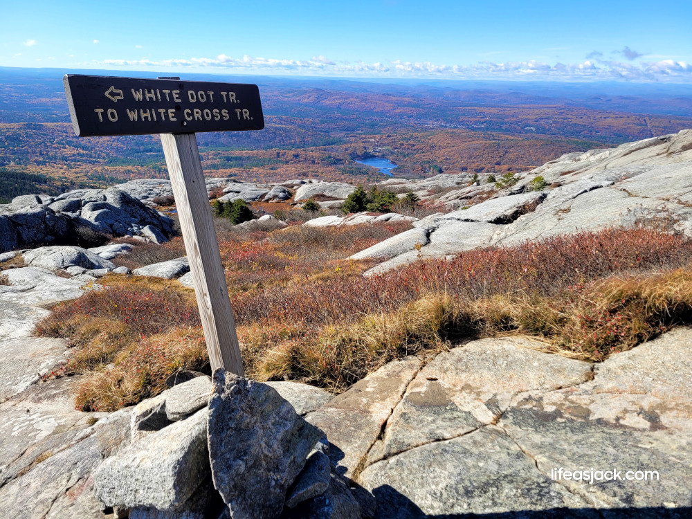
Just below the summit is a sign post indicating trail direction. Then it’s a short steep climb over open ledge to the top.
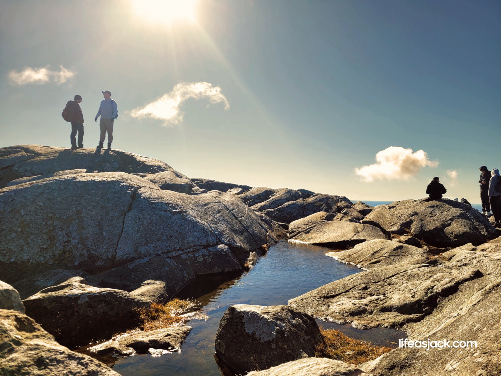
The summit was crowded, and a brisk wind made it cold. After admiring the view, I hunkered down in a low spot between the boulders. I put on the fleece and windshirt, adding a puffy down jacket. Without any exertion, I’d soon cool down. I needed the insulated jacket while perched here at the top. I pulled a flask of hot, black coffee from the pack and sat down to people watch.
It’s been a while since I visited in the fall. In the wake of Covid, I hiked here just after the world reopened. Covid masks made a great face cover for cold weather hikes.
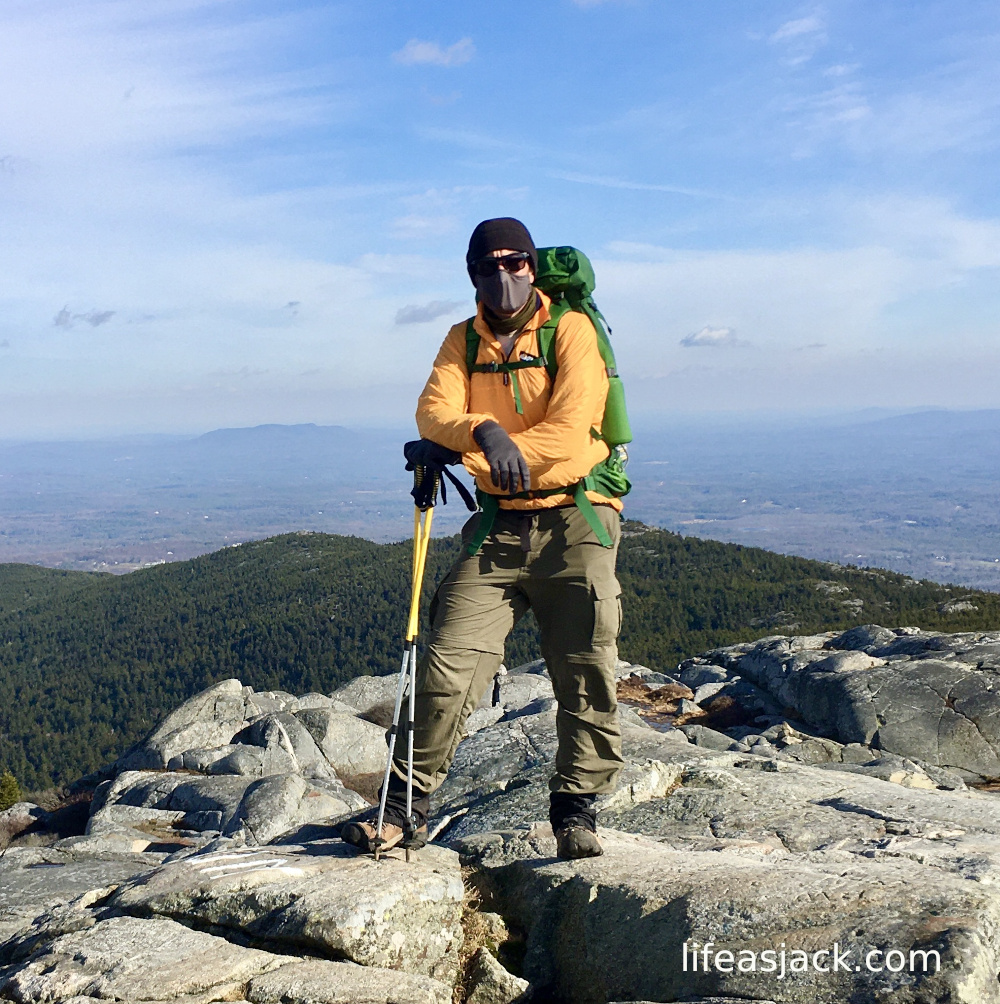
Five years on, not much has changed. I still have all the same gear but the boots were eaten by the hungry mountains!
Many first-timers were here at the peak, posing for photos and reveling in their achievement. I still get the same “hiking high” after reaching the top of a mountain, though it’s a bit more subdued. I spent a half hour camped at the top and decided to descend to warmer climes. I followed a steady stream of hikers down from the top.
I reached the junction of the White Dot Trail and White Cross. I would descend the less- steep White Cross on the way out. It would be safer than returning the way I had come. Some trail are one way- it’s always better to take a less steep path with more control over the descent. The White Cross would also offer a change of scenery.
Paused at the junction, I walked away from the crowd and found a ledge overlooking the valley. I sat for an hour, finishing the coffee, simply being present and enjoying time spent outside on a fine weekend afternoon.
The day grew old. After an hour, I packed up and made my way down the mountain.
Perhaps I’ll be back again this time next year, or in winter once the snow falls. I just know I’m was here today,and that’s as good as it gets.
