Nick and I left the city of Providence in the early morning hours of a fine June day, heading for New Hampshire. Mount Osceola and it’s sister, Osceola East Peak were on the hiking menu. After today’s hike, Nick was approaching 20 completed summits for the New Hampshire 48. I had hiked these mountains in 2018, and could only recall the highlights. I was happy to join Nick as he worked towards completion.
Mount Osceola stands at 4,315 feet, East Osceola at 4,156. Nick’s plan was to start from the trailhead on Tripoli Road and hike to Osceola first. We would continue down from the mountain, at least 200 feet, travel along the ridge, and hike to the second summit of East Osceola. This hike would be conducted as an “out and back.” We would retrace our steps over the first peak and back to the trail head. I had followed this same route in the past.
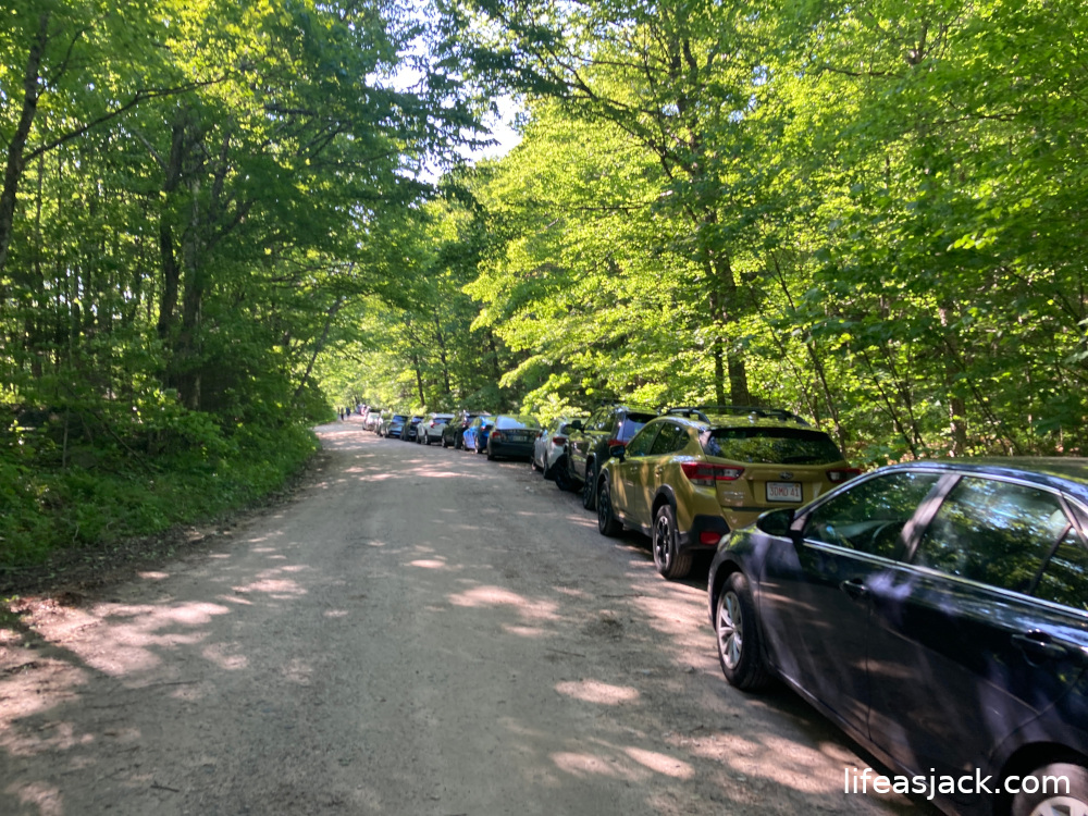
In September 2018, I carefully navigated the bumpy gravel road on the Harley, securing a spot in the small parking lot at the trailhead. This time around, we arrived to find a long line of vehicles parked well before reaching the trailhead, and parked among them.
The parking lot is equipped with a self service pay system, and composting latrines. The mosquitos were swarming us at the car where we laced our boots and loaded our packs. We quickly applied Picardin lotion to fend them off, and poles in hand, began our trip to Osceola.
The trail was rugged from the start, with large boulders that had been deposited by glaciers in the ice age. Before long, Nick and I had dropped a layer into our packs as temperatures began to warm.
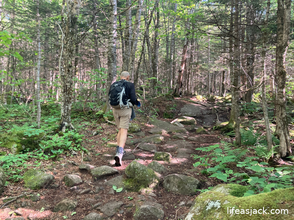
We started strong for a couple of older hikers, but the path became even more rugged. Good foot placement is key, and though the obstacle course slowed us down a little, we were still making good time at a pace of 1.5 mph.
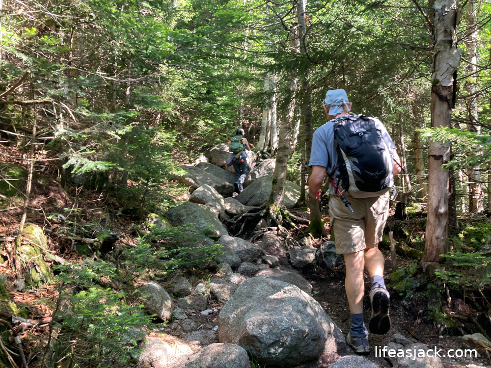
I laughed and joked with Nick about enjoying “the solitude of the mountains.” The trail was thick with hikers. Nick and I were passing scores on the trail. We greeted many with a friendly good morning. A few passed us on their way down. They must have started at dawn.
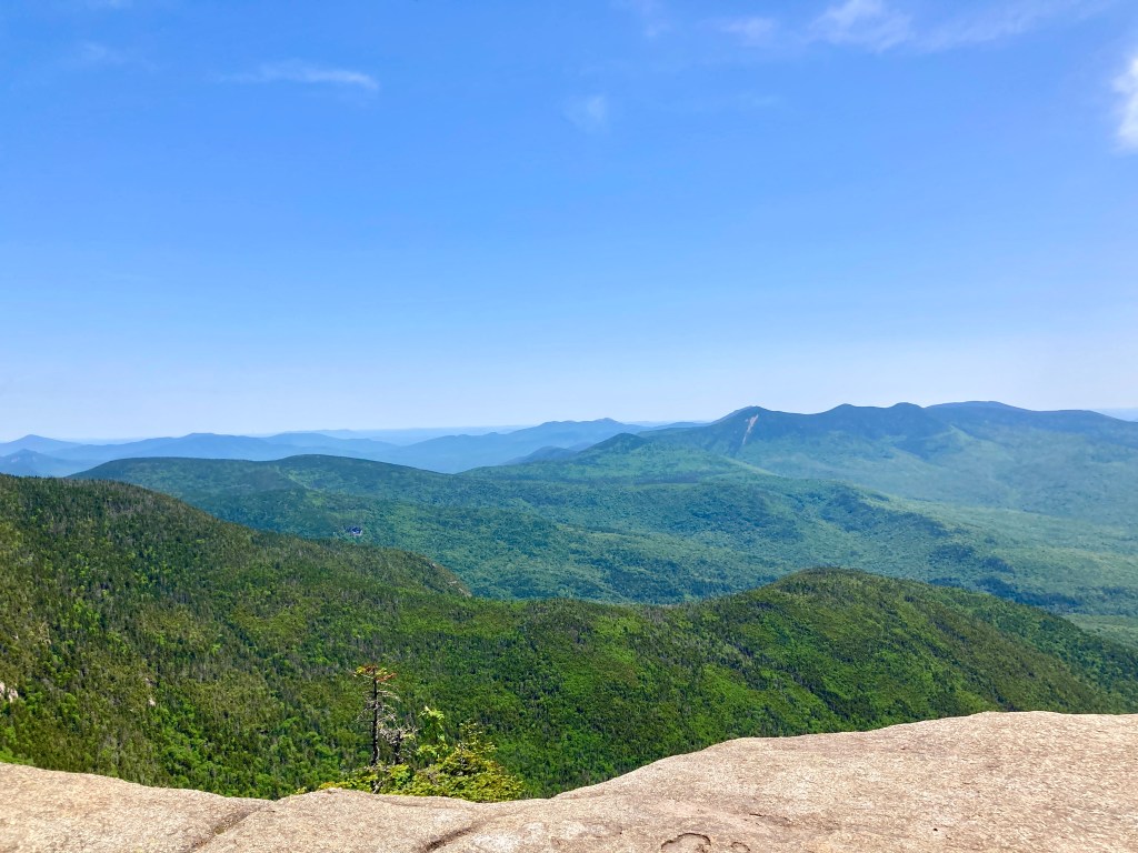
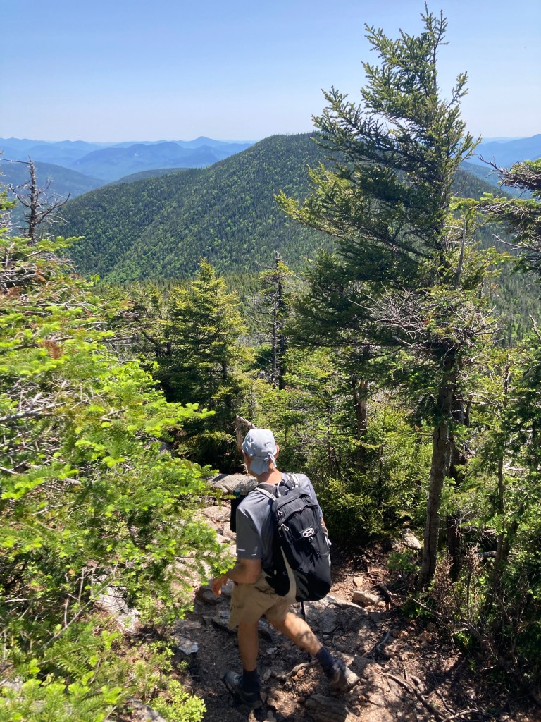
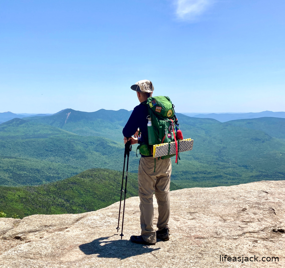
We arrived at the summit of Osceola. It sports a fantastic view of the Whites. We were a bit late for the party apparently, as it was overrun with hikers from all over the Northeast.

Summit of Mount Osceola, New Hampshire USA.
Nick and I decided to press on. We would now have to descend into the col between Osceola and East Osceola. We’d descend around 200 feet, and then hike to the summit of the second peak. There is a steep section dubbed “The Chimney” between the two that we would have to descend, and then climb on the return. Descending the “Chimney”section is not advised. There is a bypass on the way down. When we reached the junction, it took a minute or two to identify it. Headed towards East Osceola, it is to the left of the trail. It is an all dirt path that winds past the worst of the rock formation.
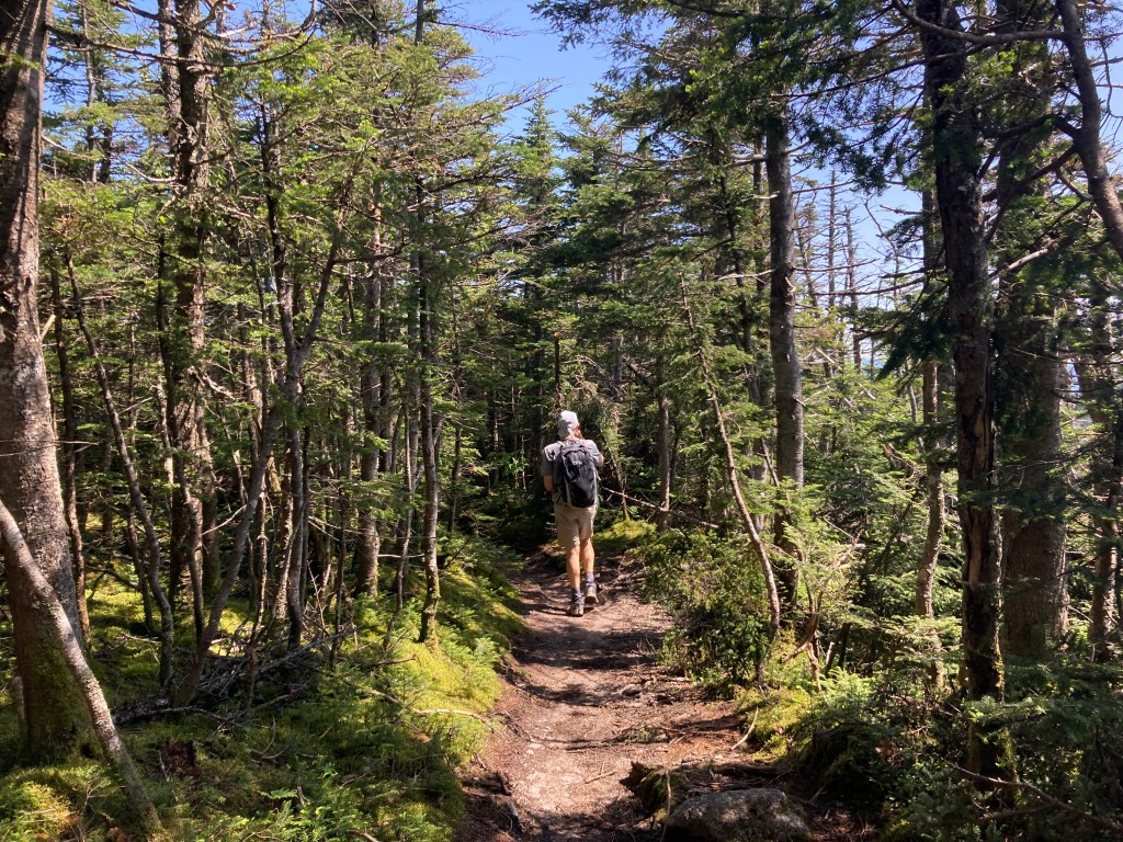
We were soon on the ridge headed to the second summit. This short section was a welcome respite from the boulder strewn path we’d encountered early in the trip.
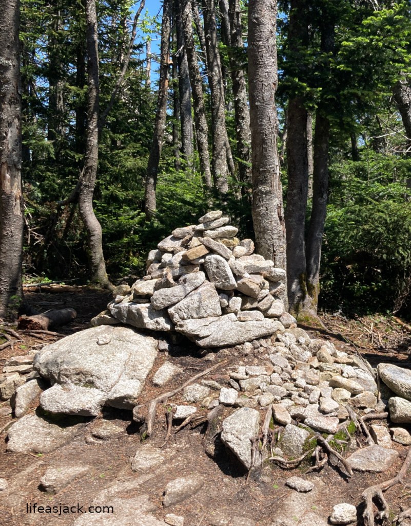
Our arrival at the East Peak was marked by a cairn. The summit has no views, and we decided to backtrack to a boulder overlooking the mountains that we’d passed few hundred yards before reaching East Osceola.
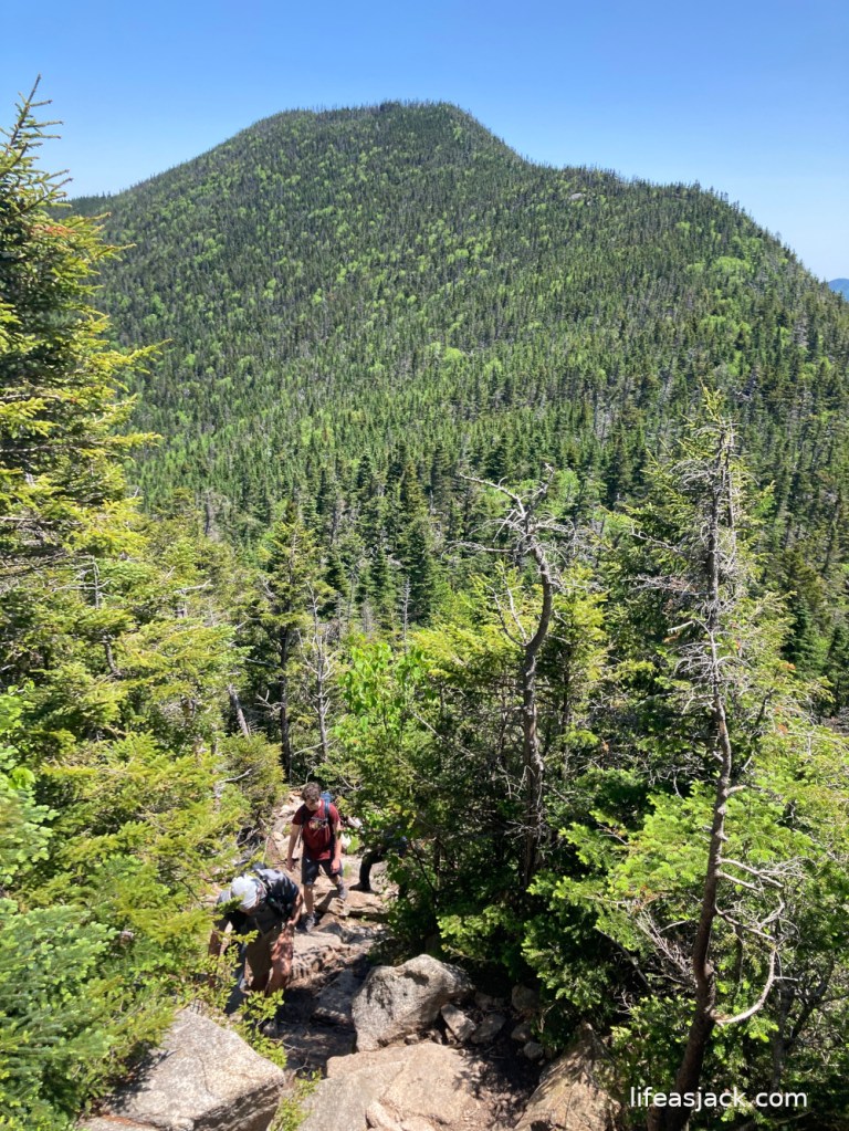
The weather was ideal. We sat enjoying the sunny day, and a slight breeze kept the bugs away. Returning to the “Chimney” We both decided we’d climb it. The steep rock face is perhaps three stories, and rather narrow. There is only enough room for one hiker to descend or ascend at a time. A google search will give you an idea of the section, as there are many posted on Youtube and the web.
The climb is easily accomplished, with many outcroppings for hand holds, but requires you to pull yourself up in places. Be sure to stow your poles before you start! It is not a section that should be hiked climbed by children or people with balance or strength issues. Nick and I both climbed it without trouble, but this section and the climb back to Osceola is a good cardio workout regaining the 200+ foot descent we’d made into the col.
Arriving back at Osceola, I had one last look from the summit before we would make our way out.
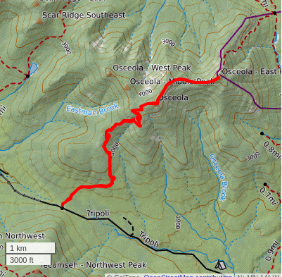
Nick and I clocked out with a 8mile, 6 hour hike. The route map and profile are included below.


Comments
3 responses to “Mount Osceola”
Osceola is one of my favorites. For a 4000-footer, you get such a quick reward with the views at the summit, but I’ve just always enjoyed that hike in general.
LikeLike
Trail was packed with new hikers, with a lot of confusion at the Chimney.” Many went down the chimney thinking it was the bypass.I always bypass going down and out to East, Climb up on the return.
LikeLiked by 1 person
I’ve only gotten to do the Chimney once so far, but that was the way that made the most sense to me as well
LikeLike