
The tops of the trees swayed, pushed by a gentle wind in the predawn hour. Looking at my dying watch, I read the time as 5:20. Without my charger, my watch’s battery would expire before the trip was finished. No matter- time was of little consequence. I did not need to be anywhere for days, and today’s chapter had yet to be written.
I was content to stay in the hammock for a few more minutes and enjoy the pleasure of not having to be dressed, shaved and weaving my way through the vehicular combat that is my normal daily routine. Yesterday’s hike had been tough, and I wanted to enjoy the quiet time before today’s push to the next waypoint.
The thru-hikers that had arrived in camp the previous evening were long gone. They had packed up in the predawn darkness, their red headlamps glowing in the gloom like giant angry fireflies. They rolled up tents and filled packs. Approaching the shelter after packing up the hammock, I found the ladies of Ohio and Canada tending camp stoves. They would soon head north as well.
I changed out of sleeping clothes and into my still wet hiking shirt I had washed the night before. Nothing dries in Vermont overnight. I braced myself for the shock of the cold, damp shirt hitting my back. In a moment it was over. The morning air was already warming,and after a minute or two, it was rather refreshing. I said good bye to my companions while I ate my breakfast, and was soon packed up. My bear can was getting lighter as I ate my way though my supplies. My load would be lighter every day by a pound, and I was sure I would lose a few pounds of body weight by the end of the week. I was burning calories at a high rate with this hike, and not putting as many in.
Temperatures today would be in the mid 80’s with clear skies. I would not see those skies from the trail. With the exception of a few peaks, the Long Trail was a continuous green tunnel.
My intent was to put in a solid 10 miles today. I would make my way to the Sunrise Shelter, approximately 6 miles north. Coming out of the forest, I would then cross the highway at Brandon Gap. Ascending back into the mountains on the other side of the road, the hike would continue, coming to an end in late afternoon at Sucker Brook Shelter. According to my topo map, the shelter had a stream close by to refill my bottles. There would be a long, dry section after Brandon where I would not have water access.
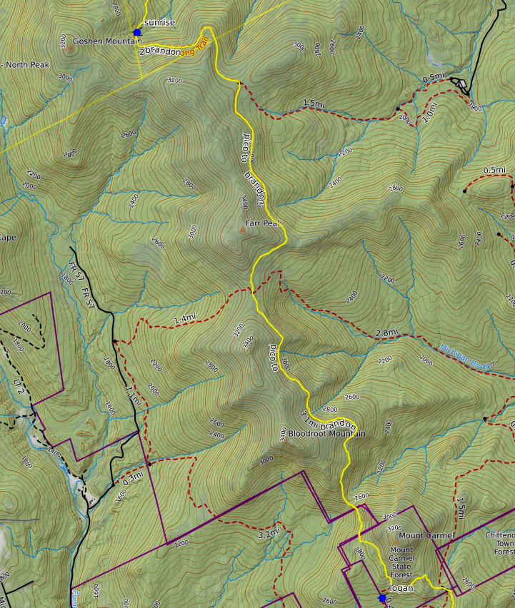
The sun was rising, casting it’s light through the forest as I began to gain elevation at the beginning of the day’s journey. I met my hiking companions from the shelter, and overtook the ladies while climbing Bloodroot Mountain. I was feeling strong this morning. The trail leveled off. On these flat sections, I was able to take advantage of my long stride to put on some speed and distance. The trail would continue along this ridge line, carrying me around Farr Peak without the need to reach it’s summit. Along my way I encountered John, a local volunteer who was performing a bit of trail maintenance. He was clearing brush from the trail with saw and axe. He was a wiry fellow of average build, perhaps a bit older than myself. It’s volunteers like this that keep the trails open and allow the rest of us the ability to enjoy them. We chatted briefly and I thanked him for his work. Soon I was on my way again. My maps showed the Sunrise Shelter to be farther north, so I was quite surprised to arrive at signage announcing its location just ahead. I decided to hike the spur trail to the shelter to take a look.
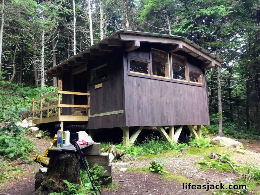
The shelter is clearly a new construction, and very well built. It’s large windows meant that it was bright inside, and a good refuge from wind and rain.The interior was just as impressive.
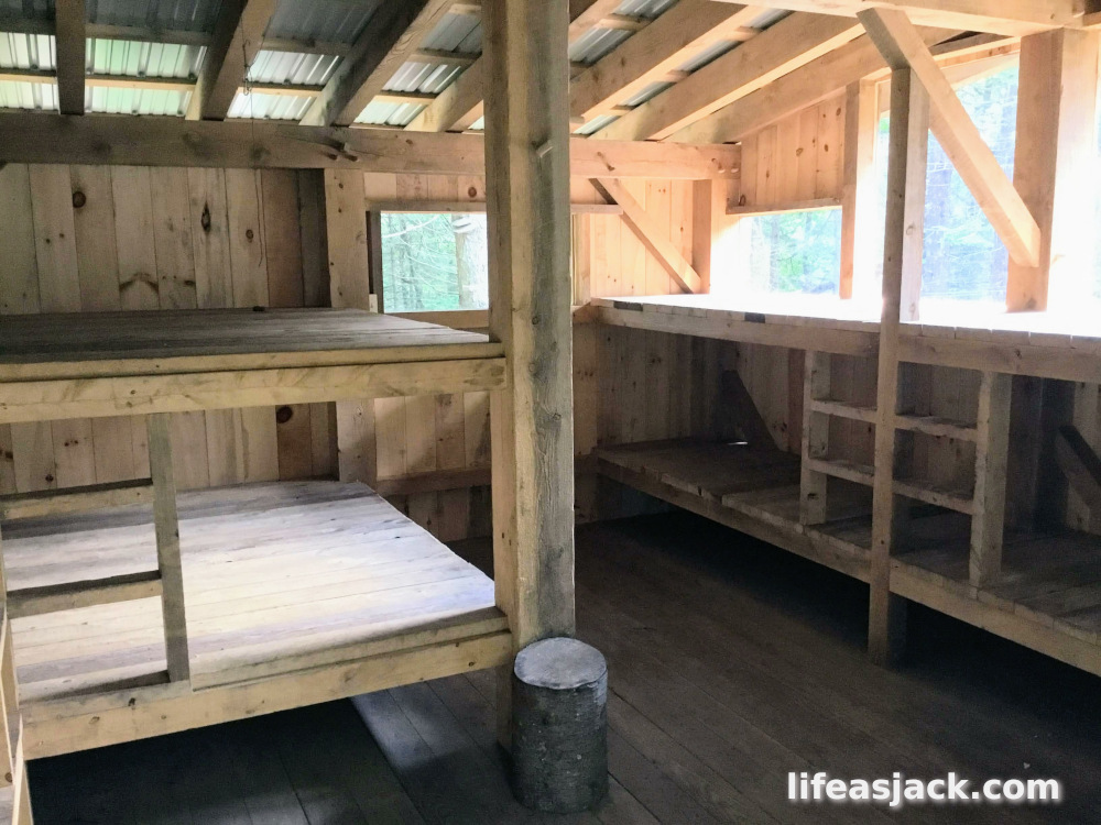
There was plenty of bunk space, and I would have been quite tempted to spend the night here if I didn’t have miles to go. I was only perhaps 5 miles along, and it was already after 9:00.
I filtered water and “cameled up” before leaving the shelter. I was trying to drink more water, as I could tell I was becoming more dehydrated. I usually drink a litre every 5 miles, but with the high temperatures, I was sweating out more than I was taking in. I would have to drink more. On my way back to the main trail, I met the ladies coming up to the shelter. They wanted to have a look as well. I estimated they had been about 30 minutes behind me. Working my way down towards Brandon Gap, I crossed a stream, and refilled the “dirty bottle.”
Descending quickly, I noted through the thinning foliage I was approaching the Great Cliffs of Mount Horrid. Ahead of me was the trailhead sign. I had reached Brandon Gap, a saddle between the mountains.
In a few hundred feet I reached the roadway. I squinted a bit. It was a beautiful sunny day. I had been under the green canopy for a day and a half, and the openness of the highway was a bit jarring.
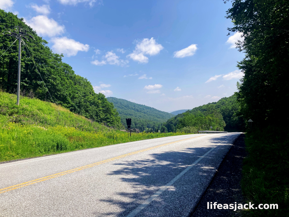
I crossed the empty road at Brandon Gap. It was very warm. I hiked through as field of waist high wildflowers. The sign announcing the reentry to the Long Trail was well off the road,and I had to look for it. The sign included some historical information about the area I was about to enter. I stepped into the cooler shade of the trees. A steep mountain stood in front of me. I would have to go up.

Comments
One response to “Long Trail 25: Logan to Sunrise”
[…] crossing the Brandon Gap at midday, I had reentered the cool, shade of the forest. It was hot. Temperatures were not ideal […]
LikeLike